$288,000 | N/A beds | N/A full baths | N/A half baths | N/A sqft
Galena, MO 65656
- N/ABeds
- N/AFull Baths
- N/AHalf Baths
- N/ASqFt
- N/AYear Built
- 70.00Acres
- MLS# 60273221
- Land
- Acreage
- Sold
- Approx Time on Market6 months, 6 days
- AreaStone
- CountyStone
- Subdivision Not In List: Stone
Overview
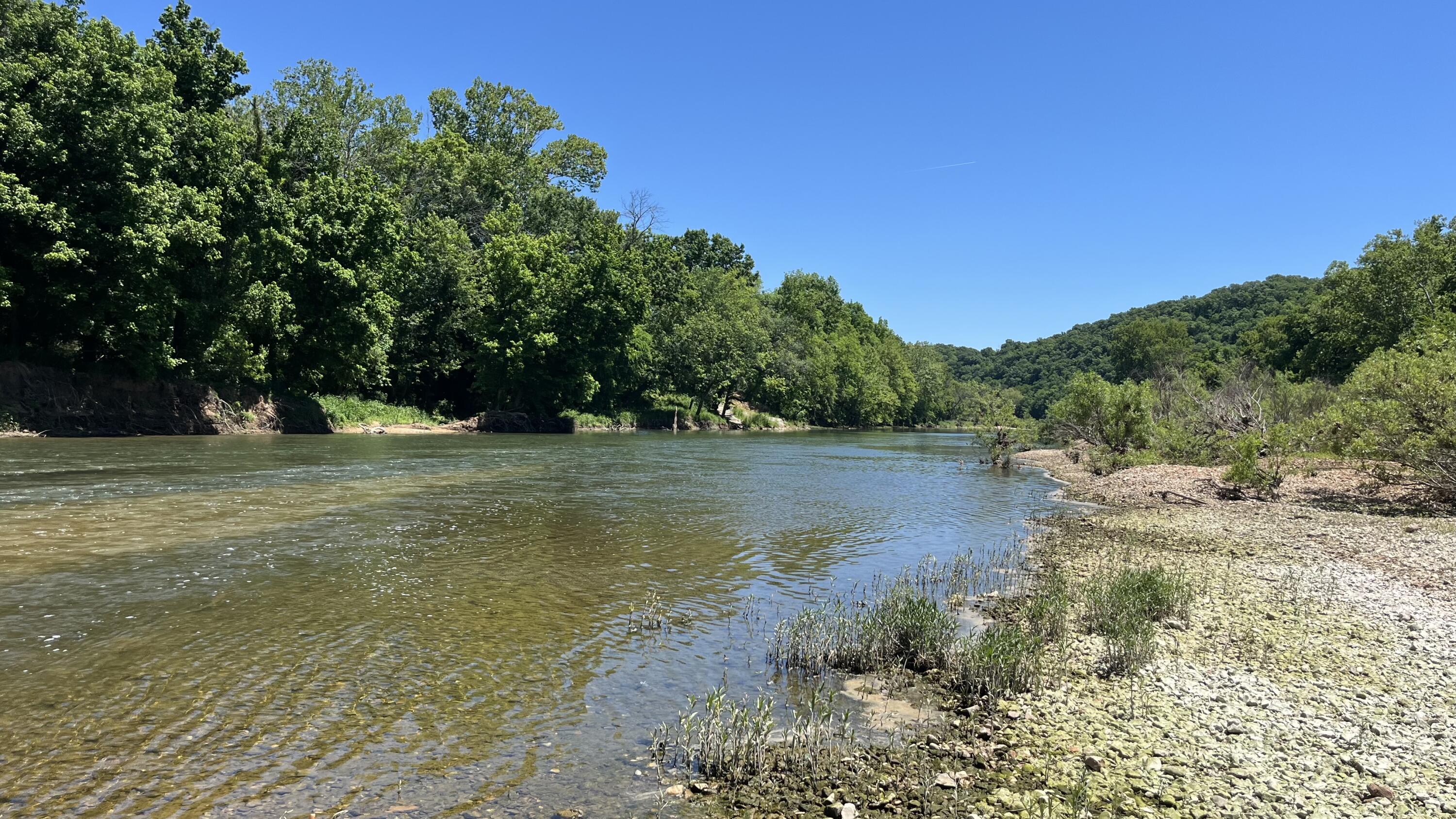
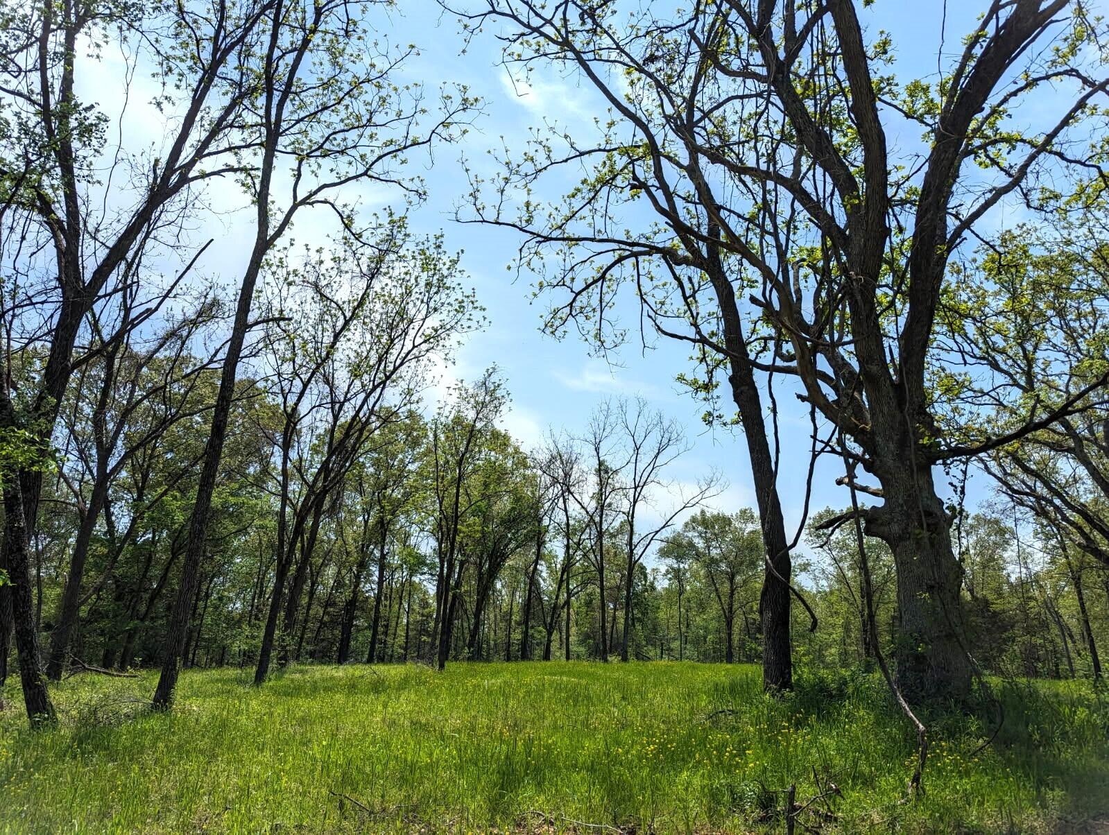
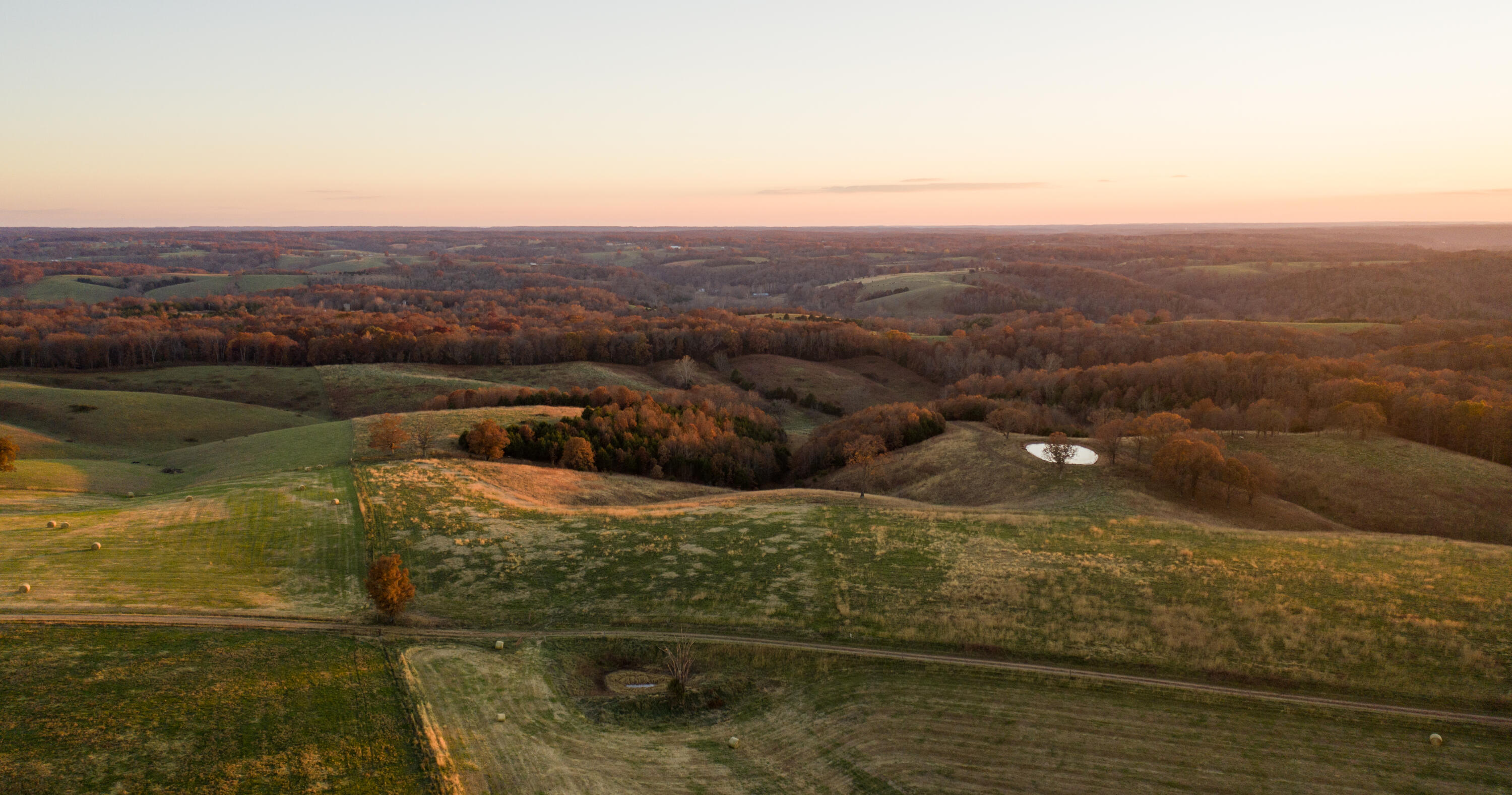
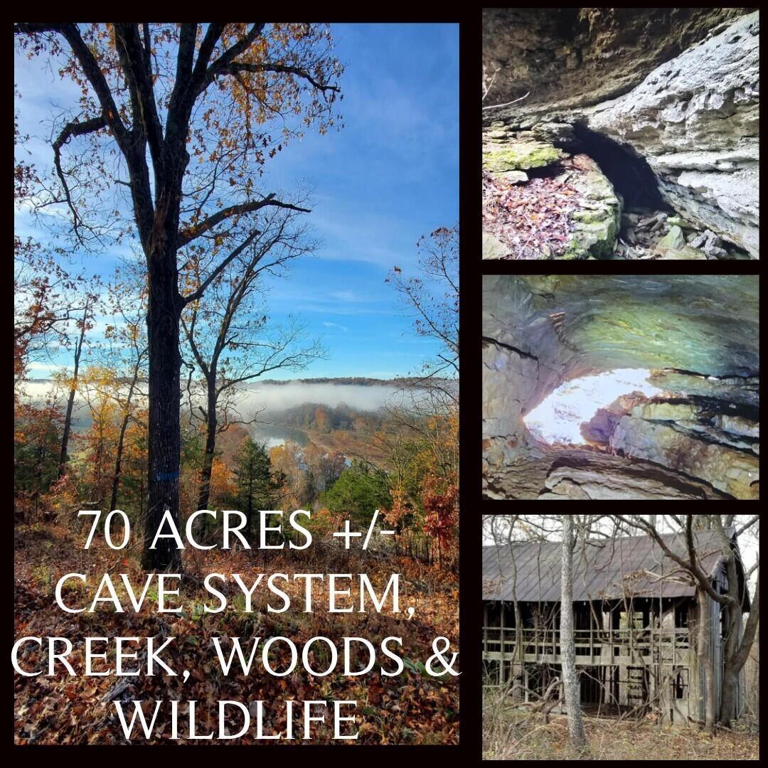
UPDATE!! ACREAGE ADDED! 80 Acres M/L with completed Survey. Year round flowing Powder Mill Creek, Property is heavily wooded and bordered by large acreages for great hunting opportunities. Unexplored cave system waits for the brave at heart. This property was known as the ''Poor Boy Camp'' from the early 1900's were as of current, finding horseshoes and relics is not uncommon around the still standing old barn and the water cistern that is still holding water to 25 feet deep. Limited restrictions, NO trailer houses or Camper living, No commercial livestock or poultry barns. Final acreage determined by survey. A drive will be completed from entrance to old barn area prior to close of escrow.
Sale Info
Listing Date: 07-15-2024
Sold Date: 01-22-2025
Aprox Days on Market:
6 month(s), 6 day(s)
Listing Sold:
1 Year(s), 6 month(s), 1 day(s) ago
Agriculture / Farm
Association Fees / Info
Hoa: No
Building Info
Basement: No
Exterior Features
Fees / Restrictions
Easements Restrict: Mobile Home Restrictions
Financial
Som Price Disclosed: $
Som Price Per Acre: $4,114.29
Garage / Parking
Garage: No
Attached Garage: No
Interior Features
Fireplaces: No
Lot Info
Topography: Hilly, Steep, Sloped, Rolling
Lot: Acreage, Mature Trees, See Remarks, Wooded
Acres: 70.00
Marina Info
Misc
Insidecitylimits: No
Other
Other Structures: Other
Foreclosure: No
Fire Disctrict: Northern Stone
Property Info
Township: 24
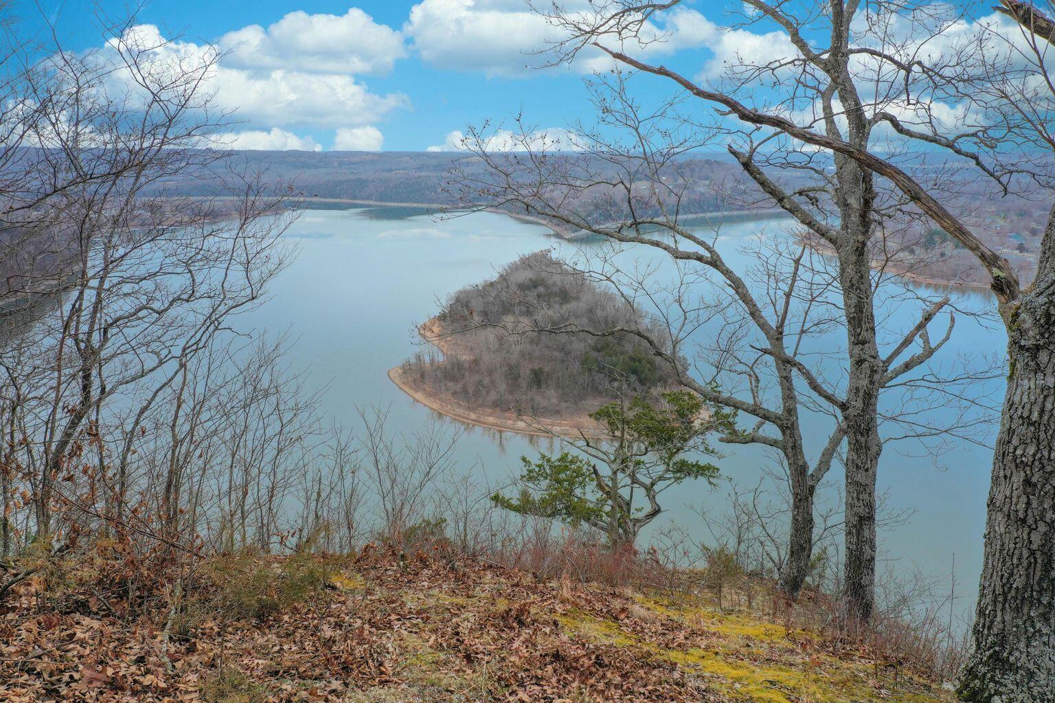
View: Mountain(s)
View: Yes
Road Surface: Blacktop
Road Responsibility: County
Road Frontage Type: County Road
Cross Street: McCord Bend
County: Stone
Tax Info
Tax Legal Description: West Side Access into property is gained from McCord Bend Road. New bulldozed roads allow easy 4x4 pickup driving into the heart of the property. SW Corner and beginning of South boundaries are from McCord Bend Rd at Gas line right-a-way continuing down to a point on West Powder Mill Creek. Turning in a Southernly direction, follow the West Powder Mill Creek branch a southern point at which the East Powder Mill Creek intersects. Headed back north up the East Branch of Powder Mill Creek to a
Tax Year: 2023
Tax Amount Annual: 212.16
Tax Provided By: Assessor Records
Unit Info
Utilities / Hvac
Utilities: Electricity Available
Waterfront / Water
Oth Water Type: Powder Mill Creek
Water Type: Spring Fed Creek
Waterfront View: None
Lake River: None
Directions
Hwy 248 west to McCord Bend Rd to sign on property.Listings courtesy of Reecenichols -kimberling City